A colleague is new to the Wellington area and frequently says she has no idea what we’re talking about when people in the office talk about nearby localities.
When I described my love of Zealandia, she did not know where it was, and eventually she asked me to create a list of “nice walks” in the area. Herewith my list, with a wee bit of guidance.
Not all of these are walks, but all are great outdoor locations. Some of these entries may turn into posts in their own right, in time.
High Points
Mount Victoria
From the car park, walk up the path to the lookout proper for views of Wellington like no other place. From there you can see the central city, with hill suburbs behind, the inner and outer harbour, Petone and the lower Hutt Valley, the harbour entrance, Miramar Peninsula, the airport, Cook Strait, Wrights Hill and much more!
This is the one spot I insist every person who ever visits Wellington must go. There are also numerous walking/biking trails on the Mount. Check a map.
Pick a stunning day for best results. There are pointers to key features at the lookout, but take a local for more flavour.
From the city, head for Newtown. Take the major left turn in the middle of the shops onto Constable Street, towards Kilbirnie and the airport.
Just before the summit of Constable Street, bear left onto Alexandra Road. After considerable distance, keep an eye out for Lookout Road on the left (the only significant road on the left) and then shortly afterwards the first right turn into Alexandra Memorial Road, where the car park is.
Mount Kaukau
Most famously the site of the giant radio/TV mast, serving MUCH of Wellington, Kaukau is also home to superb views. And… in the wrong weather, Wellington’s highest wind speeds, so pick your day with care!
Kaukau can be accessed from numerous locations via a significant network of tracks, but perhaps the most convenient route is from next to Khandallah swimming pool. I won’t try to describe the route there; use a map!
Colonial Knob
This is one place I haven’t been, but my son rides his bike up there often and tells me the views are spectacular.
Pick a stunning day and, if aviation interests you at all, when the wind is from the south — the airliners will be quite close above as they approach Wellington.
Head north on SH1 then SH59, taking the Porirua exit. Turn left over the bridge, and left again at the other end towards Tawa. Follow the signs for Kenepuru Hospital.
After turning up Raiha Street, go straight on, past the hospital. There is a car park near the top of the hill. This isn’t the shortest walk, but is by far the easiest to find. Check a map for other access points in the same area of western Porirua.
Paekakariki hill
Not really a walking attraction, but a must see view on a clear day. For maximum effect, choose a clear blue sky, little-to-no wind, and with recent rain (which will have cleared the atmosphere of dust).
On any good day you will see the Kapiti Coast and Kapiti Island, but the clearest days will reward you with seeing the contours of the upper Marlborough Sounds, some 45-90 km away!
Below the lookout point is the Escarpment Track, which can be accessed from Paekakariki township at the bottom of the hill. It’s a popular track but not for the inexperienced, as a few people have found to their cost.
Take SH1 and turn left at the SH58 junction, heading towards Pauatahanui township, basically bearing right to avoid Whitby. Just keep driving (though see the entry for Pauatahanui Wildlife Reserve Walkway). You will go through farmland, then into bush/forest, before popping out of the trees into farmland again… and then the payoff with a spectacular view of Kapiti.
Shortly after the view appears, there is a small lay-by on the left where you can stop to admire the view.
Turning right from the lay-by on a bend may not be easy, so the most common way is to continue down the road to Paekakariki township. Be warned this section requires full driver attention! Once at the bottom of the hill, return along SH59 (the former SH1) towards Pukerua Bay.
NOTE: Paekakariki Hill Road is commonly on “most dangerous roads” lists, but when driven with care it’s quite navigable. Really only the downhill section to Paekakariki is sketchy, but as a result of this the road is often closed after bad weather.
Sanctuaries and Parks
Zealandia
The Jewel in Wellington’s Crown. Some of NZ’s rarer birds can be seen here. Aside from those are flightless, they are not ‘kept’ in the sanctuary, rather mammalian predators are kept out. Many hardier species do go outside the fence and are thriving. Wellington’s Kaka and Tui populations, in particular, have ballooned since it opened.
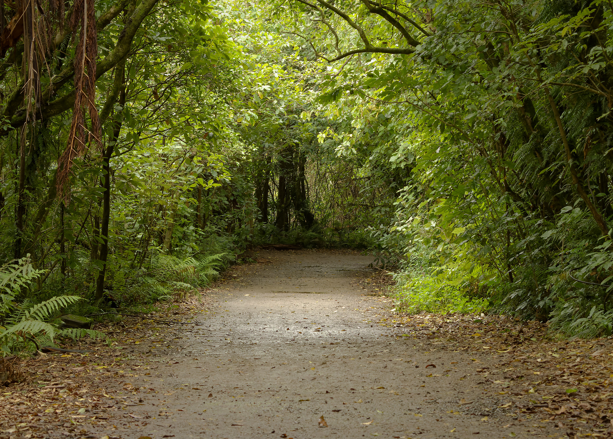
Good in just about any weather, some tracks will be more difficult going after prolonged rain (and some will be closed). You can do anything from half an hour to multi-hour walks and, even without the birds, it’s a lovely walk. In fact, the picture at the top of this page is of the upper part of Lake Road.
There are many tracks, some short, some very long. My recommended first visit is: Lake Road, Swamp Track, over the Dam, Beech Track (over the suspension bridge), then upon getting back to Lake Road, go left a little way, then (just before the bridge) go right, down Te Mahanga Track — it is the prettiest track, alongside the stream, and always has plenty of birdlife.
Also, when first going up Lake Road, check behind the metal fence on the left for Tuatara. They can be very hard to spot — my usual technique is to spot other people already watching them.
From the city, go up Bowen Street to Tinakori Road, then turn left. Just keep going, past the Botanical Gardens, towards Karori. Immediately after exiting the Karori tunnel, turn left and carefully drive down the narrow road.
If there are no car parks (often the case in the middle of the day on weekends or holidays) then come back out and turn left, then left again – there are parking areas left and right, reserved for Zealandia.
Ōtari-Wilton’s Bush
Known for its diversity of plant life (and a nursery for same), this is a nice bush walk. While not a bird sanctuary, the lush vegetation does attract plenty.
From the city, go up Bowen Street to Tinakori Road, then turn left. Just keep going, past the Botanical Gardens, towards Karori. After exiting the Karori tunnel, continue on (past the Zealandia entrance) until you reach a dip in the road with a right-angle right turn onto Whitehead Road. This becomes Wilton Road. Continue along until you see the signs for Ōtari-Wilton’s Bush. There is some on-site parking.
Wellington Botanic Gardens
What it says on the tin. These Botanic Gardens are significant in size and, befitting Wellington, perched on the side of a hill, making many tracks a bit of a climb. However, most are sealed and not difficult.
There are many, many tracks, and many entrances. Particular highlights are the Lady Norwood Rose Garden, best in summer, and the adjacent Begonia House.
Drive up Bowen Street (from bottom of Lambton Quay) and turn left up Glenmore Street. The Gardens are a little way up and there is a decent amount of on-road parking much of the way up the hill. Don’t be lured by the “main entrance” road near the botton. You can enter the gardens in multiple places from that stretch of Glenmore Street. OR, you can just catch the Cable Car up from Lambton Quay.
Coastal Walkways
Pauatahanui Wildlife Reserve Walkway
You can walk, mostly on a boardwalk, alongside the Pauatahanui inlet for over 4 km. It’s good in any weather you’re comfortable walking in, and there is plenty of birdlife to see on and around the inlet.
The middle section of the walkway is along the road around Motukaraka Point, and this is one alternate start/return point, as is the western end at Camborne.
Motukaraka Point is a destination in its own right, especially for bird lovers. You can usually see numerous birds of many species out on the mudflats when the tide is at least partially out. For this purpose, drive beyond the car parks until you reach the turning bay, then park on the grass (two wheels only if muddy!)
There are three start points available; one at each end and one in the middle.
Take SH1 and turn left at the SH58 junction, heading towards Pauatahanui township, basically bearing right to avoid Whitby. Once through the township, turn left onto Grays Road.
The first start point is immediately after that left turn. There is limited parking on the left side of the road. From here, the walkway begins down the side of the road (there is clear separation from traffic) before turning to boardwalk at the end of the long straight section.
The next start point is about half way along. Continue driving along Grays Road until you lose sight of the water, then take the left turn to Motukaraka Point. (There’s a little one-way ‘slip exit’ you can take, but the main intersection is a little further on when you can see the water again.) There is ample parking here and you can strike out in any direction, though I recommend eastwards.
The final start point is the western end of the walkway. Continue on Grays Road past Motukaraka Point. Just as the road veers away from the water and climbs, the water-ski club is on the left. The walkway here adjoins the Camborne Walkway, which can take you all the way to Mana!
Paraparaumu Beach
The best walking beach in the Wellington region in my view. A great view of Kapiti Island and you can walk for ages in either direction. And of course turn around and walk back. I’m not sure I’ve been there at high tide, but every time I go there with no planning, there is a beach to walk on. It’s just as good in winter, too, if suitably dressed.
There are shops nearby for refreshments, though the dairy on the corner can be busy on hot days selling drinks and ice creams. There are also quite a few picnic tables up on the grass on the beach side of the road.
Head north on SH1 and then turn left at Paraparaumu, down Kapiti Road. Continue to the roundabout and turn left. If you go a little way there are a few parking areas on the right, but park anywhere you spot a space as it can get REALLY busy on nice days.
Makara Beach
Auckland has Piha. Wellington has Makara Beach — our own “wild west coast”.
There is a picturesque bay and you can walk south along the stoney shore, and if you’re keen, up onto the hill among the wind turbines. From the right spot on the beach you can see both Mana and Kapiti Islands. There are not many places at sea level where you can see both so clearly.
You might guess from the wind turbines that it can be fairly windy out this way, but that’s part of the attraction. I’ve not actually been there in great weather and have always found it a great outing.
From the city, go up Bowen Street to Tinakori Road, then turn left. Just keep going, past the Botanical Gardens, towards Karori. After exiting the Karori tunnel, continue along the road, all the way through Karori, past the shops.
Right after you reach the bus turning area (on the left), the road will veer right. After driving past a moderate number of houses, you’re leaving Karori, and you’re in the back of beyond. Parts of the drive can be quite scenic. Less so for the driver, mind you, who should keep their eyes on the road.
Follow the winding road through Makara township (which is quite distinct and nowhere near Makara Beach township). You will eventually get to a junction where you should turn left onto Makara Road. Follow this through to Makara Beach.
On return, consider going via the Takarau Gorge Road. After heading away from Makara Beach, take a left at the junction instead of a right back towards Karori. This takes you to the heart of Johnsonville. It is an equally (possibly more) sketchy road, but quite beautiful in parts.